 734063, Republic of Tajikistan, Dushanbe, Ayni st., 267
From 29 August to 2 September 2026, as part of the fieldwork plan of the Research Center for Ecology and Environment of Central Asia (Dushanbe) of the National Academy of Sciences of Tajikistan, field studies on the investigation and monitoring of high-mountain lakes of the Pamirs were conducted by the scientists of the Center in the territory of Roshtqala district of the Gorno-Badakhshan Autonomous Region. During the fieldwork, aerial photography and aerial video recording were carried out using unmanned aerial vehicles (UAVs) in the areas of Durumkul and Maysara lakes.
Durumkul lake is located approximately 80 km east of the city of Khorugh and 38 km from the center of Roshtqala district, at an elevation of 3,345 meters above sea level. The length of the lake is 3.5 km, while its average width is 250 meters. Aerial photography was carried out using unmanned aerial vehicles, and detailed spatial data were collected for further study of the condition of the lake.
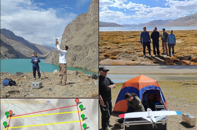
Maysara lake is located in Roshtqala district, in the southern part of the Shughon range, at an elevation of 4,213 meters above sea level. The length of the lake is 6.7 km, and its area is 9 square kilometers.
During the research, an area of 21 square kilometers was photographed using unmanned aerial vehicles. The obtained data have an accuracy of up to 29 cm and will be used to develop orthophoto maps, study the current condition of the lake, determine shoreline characteristics, and analyse subsequent changes in the surrounding area.
At the same time, along with the study of high-mountain lakes, three small glaciers in the Shokhdara River Basin and the upper part of the Gunt River Basin were also photographed using unmanned aerial vehicles. The obtained data will be used to assess the current condition of the glaciers, determine changes in their area and boundaries, and establish further monitoring of glacier dynamics.
The use of unmanned aerial vehicles in such high-mountain areas makes it possible to collect highly accurate spatial data within a short period of time and to assess the condition of lakes, glaciers, and their surrounding areas with greater accuracy. The new field data, together with the results from previous years and satellite imagery, will be used to analyse long-term changes in the hydrological and cryospheric features of the region.